Indian Geography (Part-6)
Causes of origin and characteristics of the Himalayan Mountains
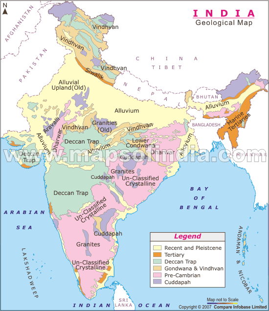
The Himalayas:-
- These Mountains are the longest mountain range in the world extending from east to west.
- Apart from the Himalayan range, other mountain ranges such as the Andes mountain range, Rocky mountain range, Great Dividing Range and Ural mountain range are in the north to south
- Himalayan length from east to west is about 2,500
- The Himalayan Mountains extend from the Nanga Parbat in Jammu and Kashmir in the west, to the Namcha Barwa mountain peak of the Tibet Plateau that is in the north of Arunachal Pradesh in the east.
- The width of the Himalayas is greater in the western part, while its width is less in the east. Due to the narrow Himalayan position in the eastern part, it has risen.
- The shape of the Himalayas is arched. The area of the Himalayas is about 5,00,000 sq. km.
- The Tibetan plateau is situated to the north of the Himalayan Mountains and the Quinolone mountain range is located to the north of the Tibetan plateau.
- The Himalayas show a southern turn at its eastern end and western end.
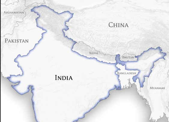
- The southern turn at the western end of the Himalayas is called the Sulaiman Mountains in Pakistan and the HindukushMountains in Afghanistan.
- The southern turn at the eastern end of the Himalayas is known by different names in the states of Northeast India -
- Arunachal Pradesh - Patkai Bum
- Nagaland - Naga Hill
- Manipur - Manipur Hill
- Mizoram - Mizo Hills
- The Himalayas cover four mountain ranges -
- Trans Himalaya
- Greater Himalaya
- Lesser Himalaya
- Shivalik Himalaya
- A branch of the Himalayas Mountain has expanded to Myanmar, which is called Arakanyomain Myanmar.
- The Himalayan Mountains are the new Fold Mountains in the world.
- The Himalayan Mountains were built in the Cenozoic Era.
- The best explanation of the origin of the Himalayan Mountains is the geomagnetism theory of Germany’s geologist Kober.
- Kober said in his theory that today where the Himalayas is, Tethys Terrain was here before.

Kober’s Principle:-
Gondwanaland was to the south and Angaraland to the north of the Tethys terrain. According to Kober, many rivers used to flow in both the Gondwanaland and Angaraland regions. These rivers deposited sediments in the Tethys Sea for a long time, causing debris to accumulate in the Tethys terrain. As the accumulation of debris increased, the Tethys terrain began to degrade in the earth's crust due to pressure, along with the accumulation of sedimentary debris. According to Kober, after sometime Tethys Terrain began to contract, which led to decreased width.
Due to the shrinkage in the Tethys terrain, the sedimentary rocks deposited in it started to bend or fold. Kober says that the action of bending occurred more on both sides of the debris, which resulted in the middle part rising up as a plane. The one side of it is the Himalayan Mountain, the other side is the Qinloon Mountain, and the middle part is the Tibetan plateau.
Note - Kober has used the word Terrain in place of word Sea.
Alfred Wegener's Principle: -
The most proven explanation of the origin of the Himalayan Mountains is believed to be Kober's geomorphic theory. In addition to Kober's geomorphic theory, Alfred Wegener's plate tectonics theory also successfully explains the origin of the Himalayan Mountains. A firm terrain is found at a depth of 200 km from the surface of the Earth. According to Plate Tectonic Theory, these terrains are divided into 6 parts; these terrains are called plates, which are as follows -
- Indian Plate
- Eurasian Plate
- African Plate
- American plate
- Pacific Plate (Pacific Ocean Plate)
- Antarctica Plate
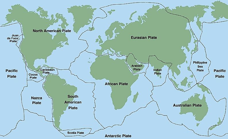
- According to the Plate Tectonic Theory, these plates are not stationary, but in a dynamic state. According to the plate tectonic theory, when the Indian plate collided with the Eurasian plate as it flowed north, the process of folding in the sedimentary debris in the Tethys Sea between these two plates started, as a result of these folds, the formation of new tropical mountains like the Himalayas took place.
- India is situated above the Indian plate.