Showing posts with label learn. Show all posts

The Himalayas

Previous                                                                                                                                                Next


Indian Geography (Part-7)


The Himalayas


The four major parallel mountain ranges are included under the Himalayas. These four mountain ranges are as follows -

  1. Trans Himalaya
  2. Great Himalaya (Highest Himalaya)
  3. Central Himalaya (Lesser Himalaya)
  4. Shivalik Himalaya


  1. The Trans Himalayas:-
  • Under the Trans Himalayas north of the Himalayas, there are three mountain ranges in the state of Jammu and Kashmir.
    • Karakoram mountain range
    • Ladakh mountain range
    • Zaskar mountain range
  • The Karakoram is the northernmost mountain range of the Trans Himalayas.
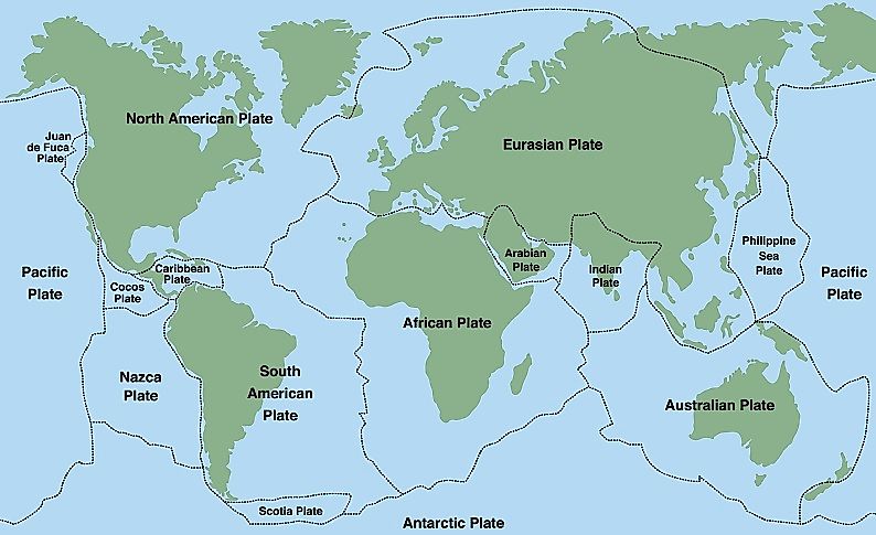
  • The Himalayas were formed by sedimentary debris deposited in the Tethys Sea, but the Trans Himalayas were not formed from sedimentary debris in the Tethys Sea, it is part of the Eurasian Plate.
  • The Trans Himalayas was formed before the Himalayas so the Trans Himalayas is a more ancient mountain range than the Himalayas.
  • Due to its height, the Trans Himalayas remain snowy throughout the year, due to which vegetation is not found
  • The Karakoram is the northernmost range not only of the Trans Himalayas but also of India.
  • India's highest mountain peak K2(Godwin Austin)is located on the Karakoram mountain range.
  • Four major glaciers found on the Karakoram mountain range are -
    • Siachen
    • Heter
    • Biafo
    • Baltoro
  • The Karakoram mountain range extends to Tibet in the east and is called the Kailash Range.
  • The Ladakh mountain range is to the south of the Karakoram mountain range. The Ladakh mountain range itself has the Rakaposhi peak. 

NOTE: - Rakaposhi peak is the steepest slope in the world.

  • The Ladakh mountain range lies between two rivers, the Shyokanadi flows to its north and the Indus River to its south. The Shyok River is a tributary of the Indus River itself.
  • The Indus River originates from the Chemayungdung Glacier of the Tibet
  • The Indus River flows north-west from the point of origin between the Ladakh and Zaskar ranges.
  • Leh, the capital of the present Union Territory of Ladakh, is situated on the banks of the Indus River. Leh is situated between the Ladakh and Zaskar mountain ranges.


  1. The Great Himalayas:-


  • Zaskar mountain range is the south of the Trans Himalayas.
  • The Great Himalayas is also known as the Supreme Himalayas, the Great Himalayas, and the Himadri Himalayas.
  • The great Himalayas are separated from the Trans Himalayas by the Shachar Zone.
  • The Great Himalaya is the highest mountain range of all the Himalayan ranges.
  • The Great Himalayas extend from Nanga Parbat in the west to Namcha Barwa peak in the east.
  • Namcha Barwa mountain range falls under Tibet.
  • The 10 highest peaks of the world fall under the Great Himalayas, out of which the names of the highest peaks are as follows – 
  • Everest
  • Kanchenjunga
  • Makalu
  • Dhaulagiri
  • Annapurna
  • The position of mountain peaks under the Great Himalayas is as follows –
  • Everest - Nepal
  • Kanchenjunga - Sikkim
  • Makalu - Nepal
  • Dhaulagiri - Nepal
  • Annapurna – Nepal


  • The Everest is the highest mountain peak in the world, whose height is 8850 m.
  • The highest mountain peak in India is K2 (Godwin Austin), but it is not located on the Himalayas. K2 (8611 m) is the second-highest mountain peak in the world.
  • Kanchenjunga is the highest mountain peak in the Himalayas in India.
  • Namchabarwa, the easternmost mountain peak of the Himalayas, is located in Tibet and Nanga Parbat, the westernmost mountain peak of the Himalayas, is located in the state of Jammu and Kashmir.
  • Following is the sequence of mountain ranges from east to west direction of Himalayas –
  1. Namchabarwa
  2. Kanchenjunga
  3. Makalu
  4. Everest
  5. Manaslu
  6. Dhaulagiri
  7. Annapurna
  • Following are the positions of mountain peaks under the Himalayas from east to west direction –
  • Namchabarwa - Tibet
  • Kanchenjunga - Sikkim
  • Makalu - Nepal
  • Everest - Nepal
  • Salu - Nepal
  • Dhaulagiri - Nepal
  • Annapurna – Nepal
  • Important mountain peaks in the Indian state of Uttarakhand – 
  • Comet
  • Nanda Devi
  • Trishul
  • Bnderpuchc
  • Badrinath
  • Everest is called Chomolungma in Tibetan language, it means the queen of mountains.
  • The Two glaciers of Himalayas in Uttarakhand are- 
  • Gangotri
  • Yamunotri
  • Gangotri is the origin of Ganga.
  • Yamunotri is the origin of Yamuna.

  1. The Lesser Himalayas:-
  • The Lesser Himalayas is in the south of the Great Himalayas and extends from the east to the west along with it.
  • Five ranges of Lesser Himalayas are important – 
  1. Pir Panjal mountain range
  2. Duladhar mountain range
  3. Mahabharat mountain range
  4. Nagtibba mountain range
  5. Mussoorie mountain range
  • The following are the positions of important mountain ranges under the Lesser Himalayas -
  1. pir panjal mountain range - Jammu and Kashmir.
  2. Dhauladhar mountain range - Himachal Pradesh
  3. Mahabharata Mountain Range - Nepal
  4. Nagtibba mountain range - Nepal
  5. Mussoorie mountain range - Uttarakhand

  • Plains are found between the Lesser Himalayas and the Great Himalayas, these are called open basins.
  • The westernmost range of the Lesser Himalayas is called Pirpanjal. It is located in the state of Jammu and Kashmir.
  • Srinagar is in the north of pir panjal mountain range, Jammu is in South, where Vaishno Devi Temple is located.
  • Banihal Pass is located on the Pirpanjal mountain range, Jawahar Tunnel is located in Banihal Pass. The Banihal Pass connects Jammu to Srinagar.
  • Dal Lake is situated between Pirpanjal and the Great Himalayas.
  • The Dhauladhar mountain range is also called Himachal Himalaya, as it is located entirely in Himachal Pradesh. Shimla, the capital of Himachal Pradesh, is situated on the Dhauladhar mountain range.
  • Mussoorie is in the east of Dhauladhar mountain Range and Nagtibba mountain range and Mahabharat mountain range is in Nepal, which is in the east of Mussoorie.
  • Lesser Himalayas do not remain snowy throughout the year, due to the region of temperate climate, the snow starts melting here.
  • While the Great Himalayas remain snowy throughout the year due to which vegetation is not found there, the lesser Himalayas being a region of temperate climate, temperate soft grasslands are found on the slopes of the Lesser Himalayas.
  • Temperate soft grasslands under the lesser Himalayas are called 'margs' in Jammu and Kashmir, for example - Gulmarg and Sonmarg
  • In Uttarakhand, the temperate soft grasslands, under the lesser Himalayas are known as Bugyal and Payal.
  • Being a region of temperate climate, many healthy tourist destinations have developed on the lesser Himalayas. Following is the description of these tourist places in different states -
  1. Jammu and Kashmir - Gulmarg, Sonmarg
  2. Himachal Pradesh - Shimla, Manali, Dalhousie
  3. Uttarakhand - Mussoorie, Ranikhet, Nainital, Windsor
  • Plain-flat valleys are found between the Great Himalayas and the Lesser Himalayas, these valleys are known locally at different places. Eg -
  1. Jammu and Kashmir - Kashmir Valley
  2. Himachal Pradesh - Kullu-Kangra Valley
  3. Nepal - Kathmandu Valley


  1. Shivalik Himalayas:-
  • The Shivalik Himalayas are the newest mountain range of the Himalayas and the lowest elevation area among the other three mountain ranges.
  • The outermost range of the Himalayas is called the Shivalik.
  • The innermost range of the Himalayas is called the Great Himalayas.
  • The independent existence of the Shivalik Himalayan Range is visible only up to the Koshi River, the Shivalik Himalayas to the east of the Koshi River has become closely associated with the lesser Himalayas, as the Himalayan range is extremely narrow in the east.
  • The Koshi river originates in Nepal and enters Bihar and joins the Ganges river.
  • In Arunachal Pradesh, Shivalik is scattered as four distinct from east to west: the names, respectively - Dfla, Miri, Abor and Mishmi |
  • Dafla, Miri, Abor and Mishmi hills are named after the tribes living here.
  • The valleys between the lesser Himalayas and the Shivalik Himalayas are called Doon and Dwar in Uttarakhand. Such as – Dehradun, Haridwar etc.
  • The Himalayas turn to the south and west at the eastern end. The western end is near Indus Gorge and the eastern end is near Dihang Gorge. Dihang is the name of the Brahmaputra river.
  • A valley with steep slopes is called a shaped valley, a gorge or a canyon.
  • In India, anthracite coal deposits are found under the Jaskar hill in Kargil. 

Causes of origin and characteristics of the Himalayan Mountains

Previous                                                                                                                                                Next


Indian Geography (Part-6) 


Causes of origin and characteristics of the Himalayan Mountains

The Himalayas:-

  • These Mountains are the longest mountain range in the world extending from east to west.
  • Apart from the Himalayan range, other mountain ranges such as the Andes mountain range, Rocky mountain range, Great Dividing Range and Ural mountain range are in the north to south
  • Himalayan length from east to west is about 2,500
  • The Himalayan Mountains extend from the Nanga Parbat in Jammu and Kashmir in the west, to the Namcha Barwa mountain peak of the Tibet Plateau that is in the north of Arunachal Pradesh in the east.
  • The width of the Himalayas is greater in the western part, while its width is less in the east. Due to the narrow Himalayan position in the eastern part, it has risen.
  • The shape of the Himalayas is arched. The area of the Himalayas is about 5,00,000 sq. km. 
  • The Tibetan plateau is situated to the north of the Himalayan Mountains and the Quinolone mountain range is located to the north of the Tibetan plateau.
  • The Himalayas show a southern turn at its eastern end and western end.
  • The southern turn at the western end of the Himalayas is called the Sulaiman Mountains in Pakistan and the HindukushMountains in Afghanistan.
  • The southern turn at the eastern end of the Himalayas is known by different names in the states of Northeast India -
    • Arunachal Pradesh - Patkai Bum
    • Nagaland - Naga Hill
    • Manipur - Manipur Hill
    • Mizoram - Mizo Hills
  • The Himalayas cover four mountain ranges -
    1. Trans Himalaya
    2. Greater Himalaya
    3. Lesser Himalaya
    4. Shivalik Himalaya


  • A branch of the Himalayas Mountain has expanded to Myanmar, which is called Arakanyomain Myanmar.
  • The Himalayan Mountains are the new Fold Mountains in the world.
  • The Himalayan Mountains were built in the Cenozoic Era.
  • The best explanation of the origin of the Himalayan Mountains is the geomagnetism theory of Germany’s geologist Kober.
  • Kober said in his theory that today where the Himalayas is, Tethys Terrain was here before. 

Kober’s Principle:-

Gondwanaland was to the south and Angaraland to the north of the Tethys terrain. According to Kober, many rivers used to flow in both the Gondwanaland and Angaraland regions. These rivers deposited sediments in the Tethys Sea for a long time, causing debris to accumulate in the Tethys terrain. As the accumulation of debris increased, the Tethys terrain began to degrade in the earth's crust due to pressure, along with the accumulation of sedimentary debris. According to Kober, after sometime Tethys Terrain began to contract, which led to decreased width. 

Due to the shrinkage in the Tethys terrain, the sedimentary rocks deposited in it started to bend or fold. Kober says that the action of bending occurred more on both sides of the debris, which resulted in the middle part rising up as a plane. The one side of it is the Himalayan Mountain, the other side is the Qinloon Mountain, and the middle part is the Tibetan plateau.

 Note -   Kober has used the word Terrain in place of word Sea.


Alfred Wegener's Principle: -

The most proven explanation of the origin of the Himalayan Mountains is believed to be Kober's geomorphic theory. In addition to Kober's geomorphic theory, Alfred Wegener's plate tectonics theory also successfully explains the origin of the Himalayan Mountains. A firm terrain is found at a depth of 200 km from the surface of the Earth. According to Plate Tectonic Theory, these terrains are divided into 6 parts; these terrains are called plates, which are as follows -


  1. Indian Plate
  2. Eurasian Plate
  3. African Plate
  4. American plate
  5. Pacific Plate (Pacific Ocean Plate)
  6. Antarctica Plate


  • According to the Plate Tectonic Theory, these plates are not stationary, but in a dynamic state. According to the plate tectonic theory, when the Indian plate collided with the Eurasian plate as it flowed north, the process of folding in the sedimentary debris in the Tethys Sea between these two plates started, as a result of these folds, the formation of new tropical mountains like the Himalayas took place.
  • India is situated above the Indian plate.


Rock System Based on Geological History Of India

Previous                                                                                                                                                Next


Indian Geography (part-5)


Rock System Of India

Geological rocks: - The term refers to rocks found under the ground. The earth was initially like a ball of fire. Over time, the rocks began to be formed for the hot earth to cool. Different types of rocks were formed in India at different times. A total of 6 types of rocks are found in India. Based on the construction period of the rocks, their order is as follows -

  1. The Archaean Rock System.
  2. The DharwadRock System.
  3. The Cuddapah Rock System.
  4. The Vindhyan Rock System.
  5. The Gondwana Rock System.
  6. The Deccan Trap.


  1. The Archaean Rock System:-
  • The Archaean rocks were first to be formed on Earth. In other words, it can be said that the oldest rocks on Earth are rocks of Archean system.
  • There are no fossils found in them.
  • The rocks of the Archaean system are found mainly in Karnataka, Tamil Nadu, Andhra Pradesh, Madhya Pradesh, Orissa, Chota Nagpur plateau in Jharkhand and the southern-eastern part of Rajasthan.


  1. The Dharwad Rock System:-
  • The rocks of the Dharwad system have been named after the Dharwad district of Karnataka, as these rocks were first discovered in Dharwad district.
  • The rocks of the Dharwad system are found mainly in two regions in India -
    • In Karnataka region
    • In Aravalli region
  • Dharwad rocks are found in three districts of Karnataka –
    • Dharwad District
    • Bellary District
    • Shimoga District
  • Economically, the rocks of the Dharwad system are quite rich. Major metals of India, which include metals like gold, manganese, copper, zinc, chromium, tungsten and iron, are found in Dharwad rocks.
  • In India, gold is found in Kolar and Hatti mines under rocks of Dharwad system.
  1. The Kuddapah Rock System:-
  • After the rocks of the Dharwad system, the rocks of the Kudappa system were formed.
  • The rocks of the Kudappa system are named after the Kudappa district of Andhra Pradesh, as these rocks were first found in the Kudappa district of Andhra Pradesh.


  1. The Vindhyan Rock System:-
  • Vindhyan rocks are found in the area under and around the Vindhya Mountains. Vindhyan system rocks are also found in some quantity in Andhra Pradesh.
  • The main feature of Vindhyan rocks is that these rocks are famous for building materials. For example -limestone, sandstone, marble etc.
  • Diamond is produced from the Panna mines in Madhya Pradesh and Golconda mines in Andhra Pradesh, these mines are located in the rocks of the Vindhyan rock system.


  1. The Gondwana Rock System:-
  • These rocks are found mainly in river valleys in India.
  • The extension of rocks of Gondwana system is found mainly in three river valleys in India.
    • Damodar river valley.
    • Mahanadi valley.
    • Godavari river valley.
  • About 98% of India's coal is found in these rocks, which is the bituminous type of coal and considered as second class coal. This means that coal is mainly found in the Damodar river valley, Mahanadi valley and Godavari river valleys in India.
  • Singaraini coalfield in Andhra Pradesh is located in the Godavari river valley.
  • Talcher Coalfield is located in the Mahanadi Valley in Orissa.
  • Jharia coalfield in Orissa is in Damodar river valley.


  1. The Deccan Trap:-
  • The Deccan Plateau, located in Maharashtra and its surrounding areas, is called the Deccan Trap.
  • Peninsular India and the continent of Africa are part of Gondwanaland, India was separated from Africa and is flowing in the north and east direction.
  • To break away from the African continent of peninsular India, a cracking flow of lava was produced on the west coast of India and the hot lava coming out of the cracks spread all over the surface. After this lava froze and a plateau was formed, it is called the Deccan Plateau. The rocks formed by the deposition of lava are called basalt rocks. Therefore, when weathering of these basalt rocks occurs, the soil formed from it is called black soil.
  • The main part of Deccan Trap is located in the state of Maharashtra, about 75-80% of it is spread in Maharashtra and some part in the states of Madhya Pradesh and Gujarat.
  • Black soil is formed from lava rocks, hence it is also called lava soil. Black soil is also called Rengur soil. Black soil is considered suitable for cotton cultivation, hence it is also called Kapasi soil.


Sea Borders of India.

Previous                                                                                                                                                Next

Indian Geography (part-4)


Unclos (1982) 

United Nations Convention on the law of the sea:- 

The United Nations Convention on the Law of the Sea (UNCLOS), also called the Law of the Sea Convention or the Law of the Sea treaty, is the international agreement that resulted from the third United Nations Conference on the Law of the Sea (UNCLOS III), which took place between 1973 and 1982. The Law of the Sea Convention defines the rights and responsibilities of nations for their use of the world's oceans, establishing guidelines for businesses, the environment, and the management of marine natural resources.

Important terminologies:- 


  • Baseline:-
The baseline from which the territorial sea is measured is the low-water line along the coast as marked on large-scale charts officially recognized by the coastal state. This is either the low-water mark closest to the shore, or alternatively, it may be an unlimited distance from permanently exposed land, provided that some portion of elevations exposed at low tide but covered at high tide is within 3 nautical miles or 3.45 statute miles (5.5 km) of permanently exposed land.

  • Internal waters:--
Waters landward of the baseline are defined as internal waters, over which the state has complete sovereignty: not even innocent passage is allowed without explicit permission from said state. Lakes and rivers are considered internal waters.

  • Territorial sea:- 
According to UNCLOS, the territorial sea can be defined as the area which extends up to 12 nautical miles from the baseline of a country’s coastal state. The territorial sea is under the jurisdiction of that particular country; however, foreign ships (both merchant and military) ships are allowed passage through it.

A country has full authorization in this region.

  • Contiguous zone:-

The contiguous zone can be defined as the belt which extends 12 nautical miles beyond the territorial sea limit.

A coastal state’s control on this area is limited to prevention of actions which can infringe its customs, fiscal, and immigration laws. It can also act if any activity in the contiguous zone threatens regulations in the territorial sea.

  • Exclusive economic zone
The exclusive economic zone can be defined as a belt of water which extends up to 200 nautical miles from the baseline of the coastal state. Thus it includes both territorial sea and contiguous zone.

The exclusive economic zone provides the coastal state control over all economic resources such as fishing, mining, oil exploration, and marine research.


Difference between Gulf and Bay:-
  1. A gulf is much larger than a bay.
  2. A gulf is said to be a large body of water that is surrounded by land and having only a narrow entrance along a strait. A bay is also a large body of water that is surrounded by land but not as enclosed as a gulf. Moreover, the bay has a wider opening than the gulf.
  3. A gulf is a body of water in which the water has eroded very deeply into the adjoining land. On the contrary, a bay has an inward land curve.
  4. Most of the bays are formed because of the erosion of soft rock and clay by the waves. When looking at a single gulf, it is generally fashioned along linear shores. If the shoreline is irregular and consists of complex geologic structures, a group of gulfs are formed 

Examples:- 

The Bay of Bengal, Gulf of Mannar


 If you have any query, please feel free to comment and ask. 

Islands of India

Previous                                                                                                                                                Next

Indian Geography (part-3)

Islands of India


  • The Himalaya is the longest mountain range in the east-west category. 
  • It turns to the south after reaching Arunachal Pradesh and enters in the Bay of Bengal. Andaman & Nicobar Islands are the parts of Himalayas. 

Andaman and Nicobar Islands can be categorised in two different groups of islands: Andaman and Nicobar. 
Which itself have several islands in them. 

Talking about and the Andaman Islands specifically, it has four major islands:

1. North Andaman(The highest point of Andaman is saddle peak.) 
2. Middle Andaman( The largest island of this group. ) 
3. South Andaman (Portblair, the Capital of Andaman and Nicobar is situated on this Island. ) 
4. Little Andaman.

Nicobar Island group consists of two major Islands: 
1. Car Nicobar. 
2. Great Nicobar (The southernmost point of Indian territory, the Indira Point 6°4' N is in great Nicobar.) 


Andaman and Nicobar islands are separated by 10-degree channel or specifically little Andaman and car Nicobar are separated by 10-degree channel


There are two islands besides Andaman Island group first is Narcondam Island which is a dormant volcano and the other one is Barren Island which is the only active volcano of India. 

  • The smallest union territory of India is Lakshadweep. The capital of Lakshadweep is KAVARATTI
  • The largest island of Lakshadweep is ANDROTT
  • Minicoy Island is situated in South of Lakshadweep

Lakshadweep is a Coral island. The shells of Coral are made of calcium carbonate. 


  • Kolkata is not a seaport but a river port. 
Two islands near the end of Hooghly river are, 

1. Gangasagar (India) 
2. New Moore (Bangladesh) 

  • Wheeler Island in Odisha which is also called Abdul Kalam Island is located on the end of Brahmani river.  
NOTE:- Missiles are launched for tests from this Island. 


  • Sriharikota Island of Andhra Pradesh is a launchpad of ISRO (Indian Space Research Organisation), Satish Dhawan Space Centre. 


  • Pamban Island Tamil Nadu which is located in Bay of Mannar. 
  • Rameshwaram is located on Pamban Island. 
  • The southernmost point of Pamban Island is Dhanushkoti


  • Aliya bet island, of Gujarat, is located in Bay of Khambhat. It is at the endpoint of Narmada river. It has large deposits of Petroleum, which are not yet been extracted. 

  • Mumbai is located on salsette Island. 


This is a basic introduction of Indian geography. If you have any query, please feel free to comment and ask. 

India and it's Neighbour countries

Previous                                                                                                                                                Next

Indian Geography (part-2)

Countries having Land boundaries with India:-


  • India shares its border with seven countries-
  1.  Pakistan. 
  2. Afghanistan. 
  3. China. 
  4. Nepal. 
  5. Bhutan. 
  6. Myanmar. 
  7. Bangladesh.
  • States touching neighbouring countries:-
1. Pakistan 
  • Gujarat. 
  • Rajasthan. 
  • Punjab. 
  • Jammu and Kashmir( not a state anymore now a union territory).
2. Afghanistan 
  • Jammu and Kashmir*.
3. China
  • Jammu and Kashmir*. 
  • Himachal Pradesh.
  • Uttarakhand Sikkim. 
  • Arunachal Pradesh.
4. Nepal
  • Bihar. 
  • Uttar Pradesh. 
  • Uttarakhand. 
  • West Bengal. 
  • Sikkim.
5. Bhutan
  • West Bengal. 
  • Sikkim.
  • Assam. 
  • Arunachal Pradesh.
6. Myanmar
  • Arunachal Pradesh. 
  • Nagaland. 
  • Mizoram. 
  • Manipur.
7. Bangladesh
  • Assam. 
  • West Bengal. 
  • Meghalaya. 
  • Tripura.
Some important points:- 
  • Tripura is covered from three sides by Bangladesh.

  • There are three Indian states that shares boundary with three countries:-
1. Jammu and Kashmir(Now a UT) {Pakistan, Afghanistan, China}.
2. West Bengal {Nepal, Bhutan, Bangladesh}.
3. Sikkim {China, Nepal, Bhutan}.

Countries that do not share land boundaries with India but our neighbours

  • Sri Lanka
  • Maldives

Important terminologies to Remember


1. Durand line:-  The Durand Line is an international 2,430-kilometre (1,510 mi) border between Afghanistan and Pakistan. It was originally established in 1893 as the international border between British India and Afghanistan.

2. McMahon line:- The McMahon Line is the demarcation line between the Tibetan region of China and the North-east region of India.


3. Radcliffe line:- The Radcliffe Line was the boundary demarcation line between the Indian and Pakistani portions of the Punjab and Bengal provinces of British India.

Misc. Fact:-

  • Largest state according to the area (in descending order) are
1. Rajasthan. 
2. Madhya Pradesh. 
3. Maharashtra.
4.Uttar Pradesh.

  • Smallest state / UT is Lakshadweep.
  • The state which shares its boundary with the maximum number of States is Uttar Pradesh. It shares its boundary with 8 neighbour States. Those are-
1. Uttarakhand.
2 Himachal Pradesh.
3. Haryana.
4. Rajasthan.
5. Madhya Pradesh.
6. Chhattisgarh.
7. Bihar.
8. Jharkhand.

  • The largest district of India in terms of area is Kutch of Gujarat.
  • The smallest district of India in terms of area is Mahe of Pondicherry.

This is a basic introduction of Indian geography. If you have any query, please feel free to comment and ask. 


Basic Introduction to Geography

Indian Geography (part-1)                                           Part-2


Latitude and longitude are a system of lines used to describe the location of any place on Earth. Lines of latitude run in an east-west direction across Earth. Lines of longitude run in a north-south direction. Although these are only imaginary lines, they appear on maps and globes as if they actually existed.


Latitude:-


Lines of latitude (also called parallels) circle Earth parallel to the Equator. The Equator is an imaginary line that lies halfway between the North Pole and the South Pole. It runs east-west all the way around Earth. Lines of latitude describe positions north and south of the Equator.

Lines of latitude are measured in degrees (°). Degrees may be broken down into smaller units called minutes (′) and seconds (″). The Equator is 0°. The North Pole is 90° north (N), and the South Pole is 90° south (S). Lines of latitude north of the Equator are numbered from 1° to 89° N. Lines of latitude south of the Equator are numbered from 1° to 89° S.


Longitudes:-


Lines of longitude run between the North Pole and the South Pole. These lines are also called meridians. Like lines of latitude, meridians are measured in degrees, minutes, and seconds.

The north-south line that marks 0° longitude passes through Greenwich, England. This is called the Greenwich, or prime, meridian. Greenwich was chosen for the prime meridian because when the system of latitude and longitude was established Great Britain was a world leader in exploration and map-making.


Concept Of Time Difference:-

The Earth rotates from west to East and takes 24 hours to rotate a full circle on its own axis, which causes day and night. As discussed above we all knew that the earth can be divided into 360 equal parts, which are called longitude. if we do a little bit of math here 

360° in 24 hours 
24 hours = 24×60 minutes =1440 minutes
Now
360° in 1440 min 

So the earth will rotate 1° in 1440÷360= 4 minutes

we can clearly reach to a conclusion that the time taken by Earth to rotate 1 Degree on its axis is 4 minutes. 

All-time zones are measured from a starting point centred at England's Greenwich Observatory. This point is known as the Greenwich Meridian or the Prime Meridian. Time at the Greenwich Meridian is known as Greenwich Mean Time (GMT) or Universal Time.

We just need to take the value of longitude at that place and multiply it by 4, after performing this little math we get the time difference that place has with respect to the Greenwich line.

The geographical position of India:-


  • The total area of India (Mainland + Islands) is 3287000 squares kilometres.
  • India is situated in Northern hemisphere or specifically North Eastern hemisphere.
  • India's latitude stretch is from 8°4' N to 37°6' N.
  • Longitudinal stretch is from 68°7' E to 97°25' E.
NOTE:- The mainland of India starts from 8°4' N but the southernmost point of India is Indira Point in great Nicobar which is at 6°4' N.
  • India is covering a total of 30 longitudes roughly from 68° E to 98° E. 
So, Total time is taken to rotate these 

30 longitudes will be 4 x 30= 120  minutes=  2 hours.

From here we can clearly see that there is a difference of 2 hours in time of the easternmost point of India(Kibithu in Arunachal Pradesh) and the westernmost point of India(Ghuar Moti, the Kutch District of Gujarat) in other words the sunrise in Eastern states occurs 2 hours before the Western States.


To solve this problem of time difference every country takes a reference point (generally at the middle of the longitude passing through the country) for their Standard Time.

  • India has taken the Indian standard time with the reference to the 82°5' E longitude which passes from Naini Prayagraj.
  • Indian Standard Time Longitude 82°5' E passes through a total of five states of India. These are as follows -
  1.  Uttar Pradesh.
  2.  Madhya Pradesh.
  3. Chhattisgarh.
  4. Odisha.
  5. Andhra Pradesh.
  • Tropic of Cancer 23°5' N passes through 8 states of India. These are as follows - 
  1. Gujarat.
  2. Rajasthan. 
  3. Madhya Pradesh. 
  4. Chhattisgarh.
  5. Jharkhand.
  6. West Bengal. 
  7. Tripura. 
  8. Mizoram.
NOTE:- Tropic of Cancer is longest in Madhya Pradesh.


  • Ranchi(capital of Jharkhand) is situated on the line of cancer. 
  • Two more cities are closest to the line of Cancer are Gandhinagar (Gujarat), Bhopal (Madhya Pradesh).


  • Land border of India is 15,106.7 km.
  • Coastline length of the mainland is 6100 kilometre and coastline length with Islands is 7516 kilometre.
  • The total length of the Indian border 22716 kilometres (approx.).

  • There is a total of 9 states of India which have a coastline. 
             Gujrat       Maharastra       Karnataka       Goa         Kerala
             (Eastern Coast)

            Tamil Nadu    Andhra Pradesh       Odisha       West Bengal
            (Eastern Coast)

  • States with the longest coastline (Descending)
  1. Gujarat. 
  2. Andhra Pradesh.
  3. Tamilnadu.

  • State* with the smallest coastline is Goa.
  • UT* with the smallest coastline is Puducherry,

This is a basic introduction of Indian geography. If you have any query, please feel free to comment and ask.